
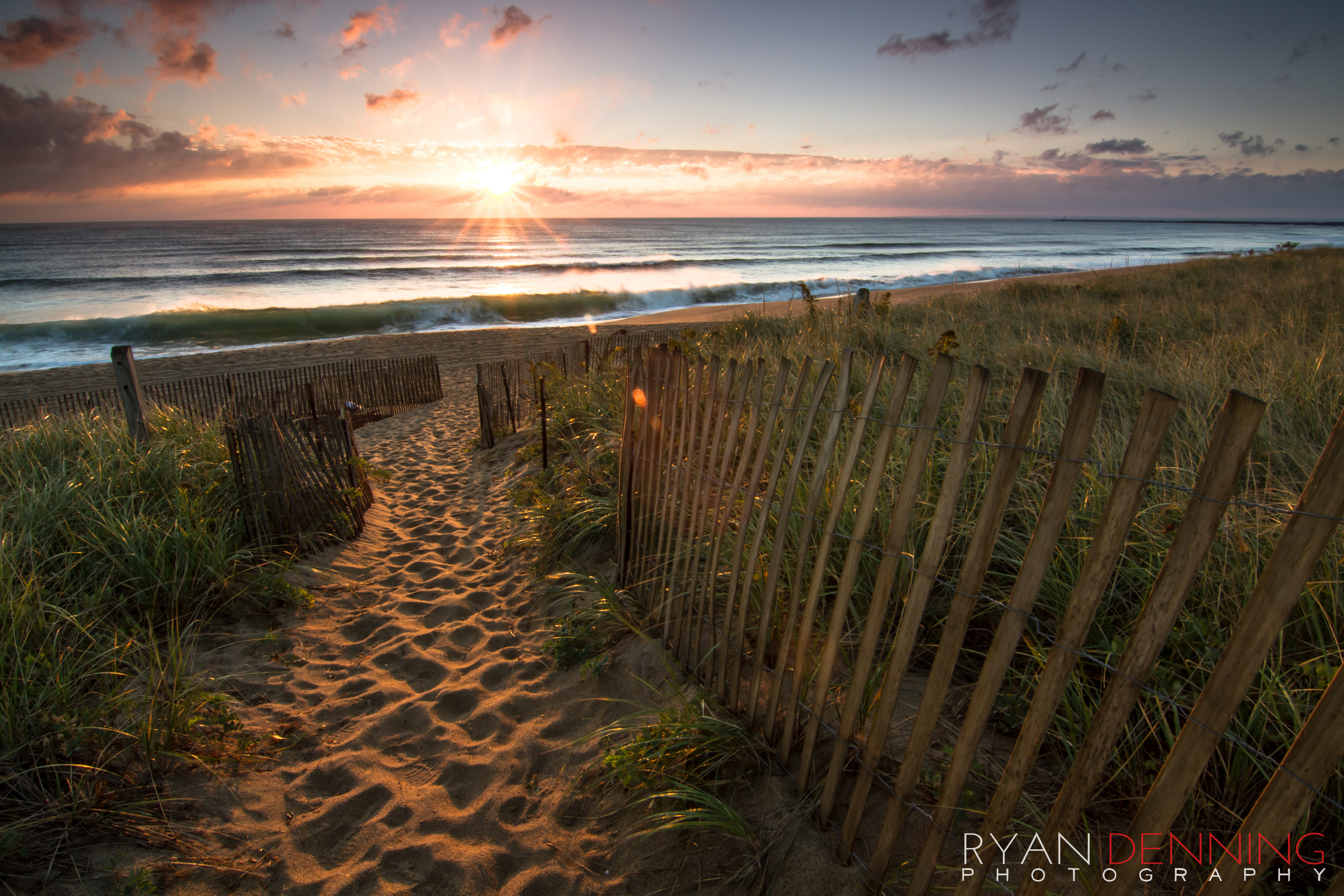


Fall on the Seacoast | October 1, 2013
Finally! What a release.
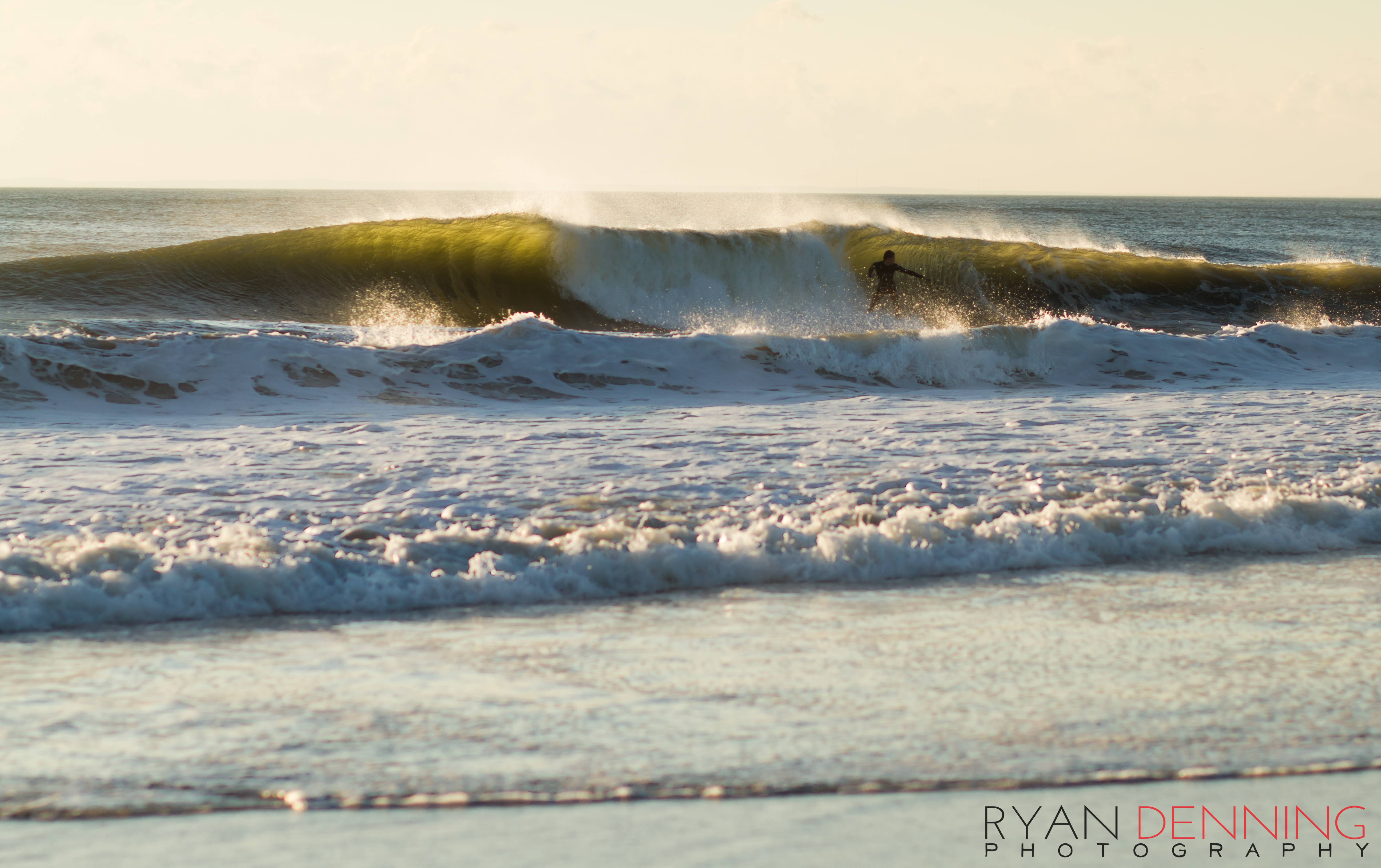
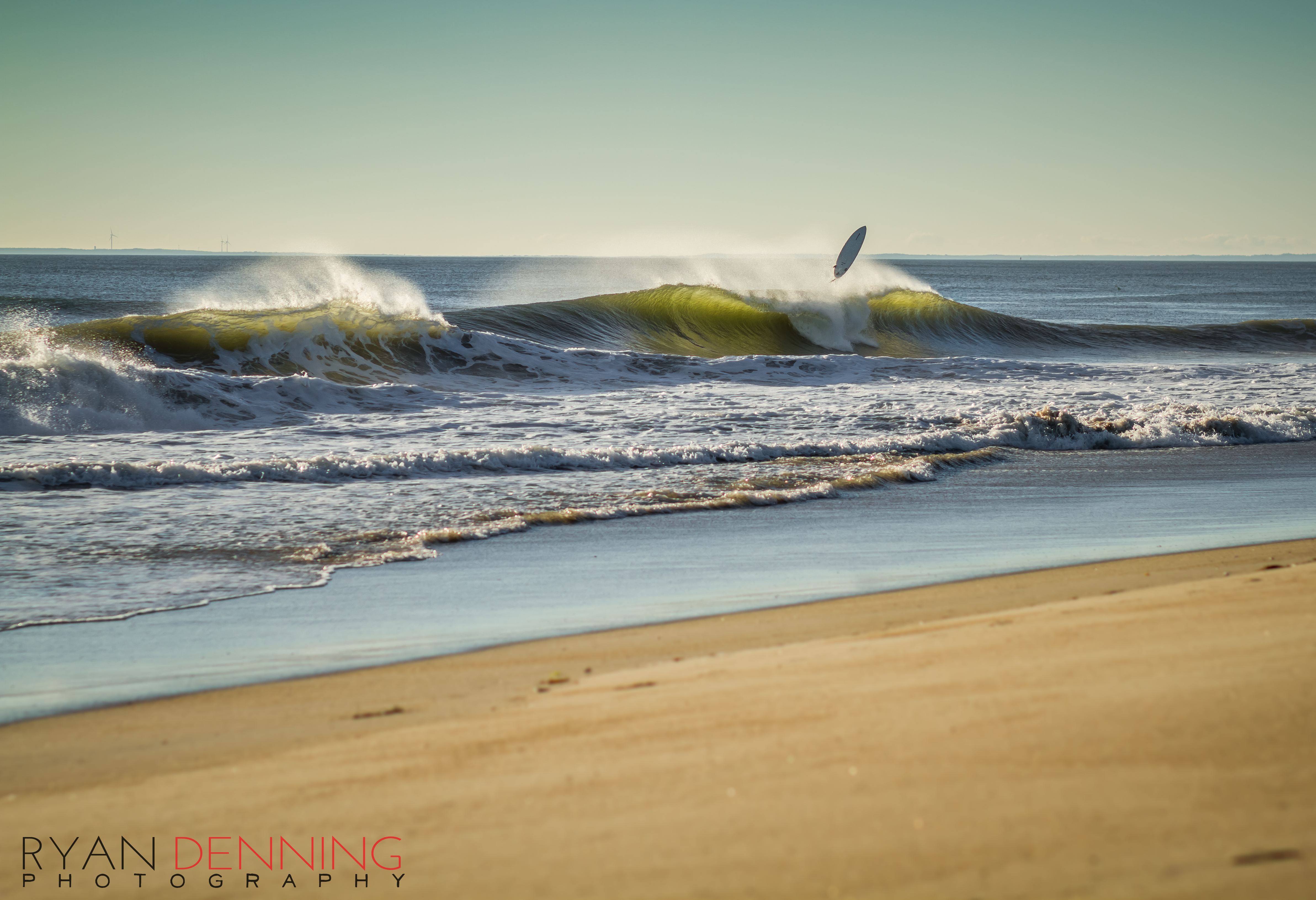
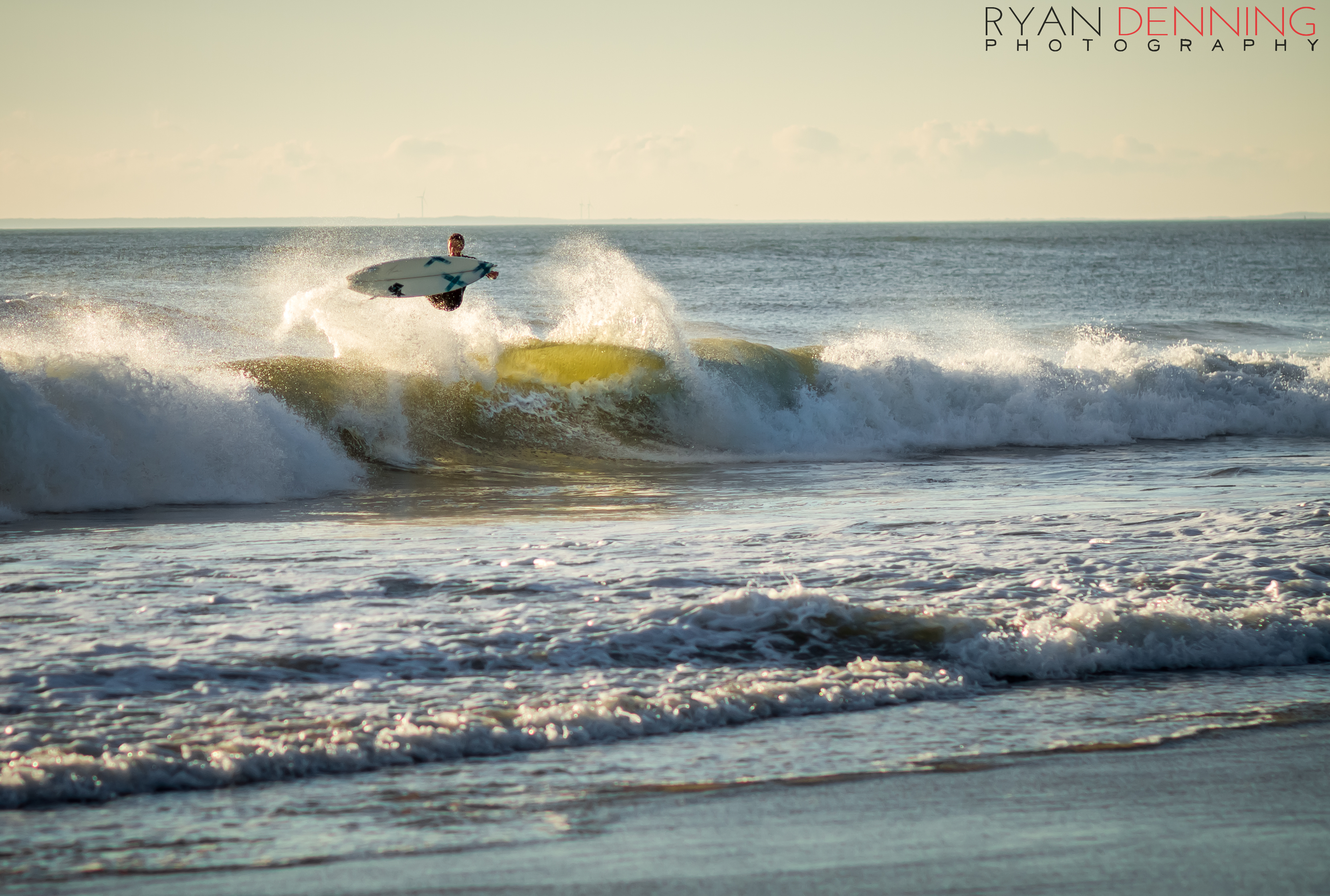
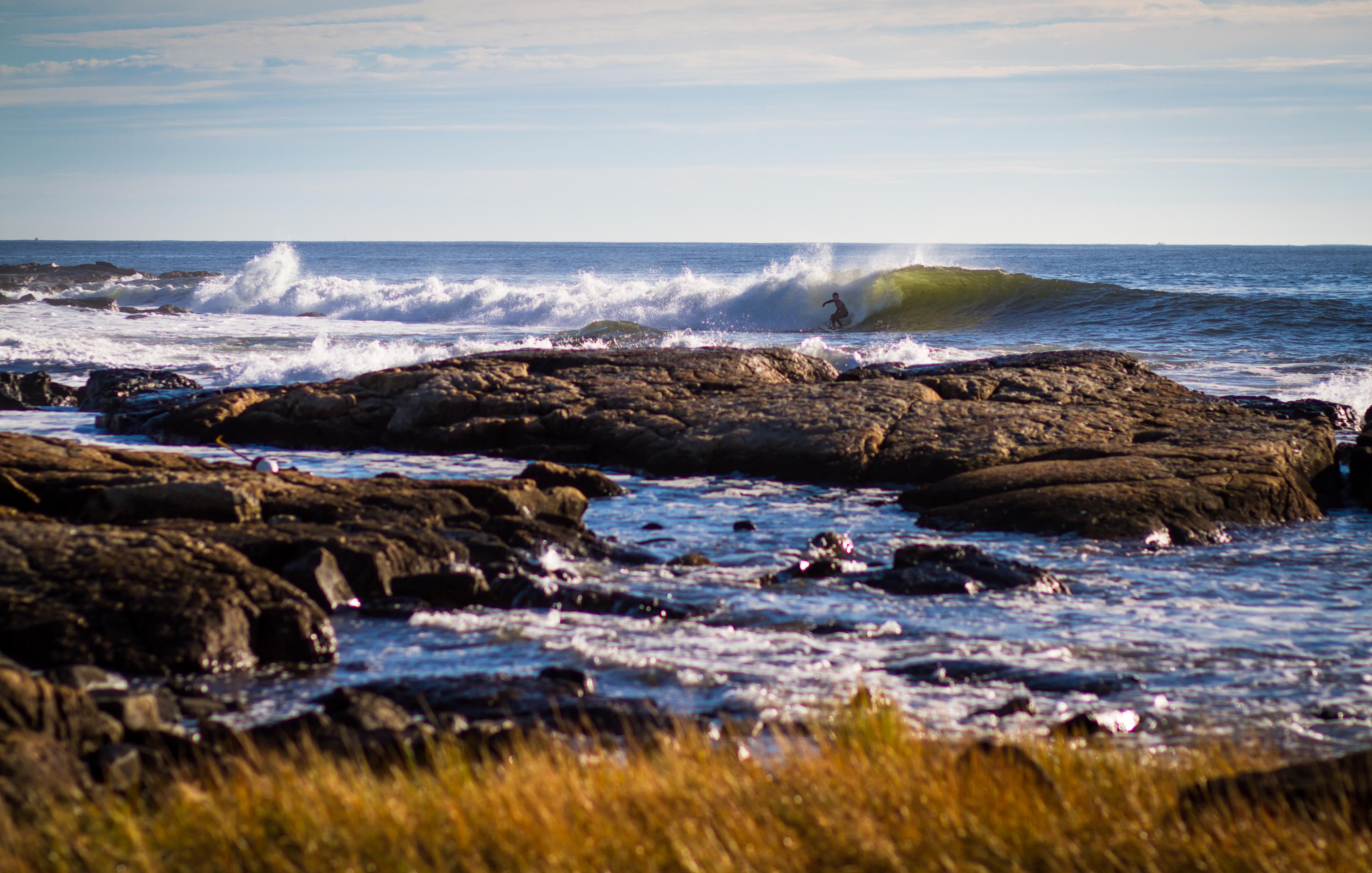
After a long, flat, ordinary summer and a dismal hurricane season (so far?), we’ve received a welcomed autumn swell. The small Easterly swell direction and funky tide made for wobbly and sometimes walled out conditions in many of our favorite spots. Alternatively, it lit up some not-so-frequented spots along the coast that accept the E swell exclusively. Regardless, I spent most of the morning Tuesday doing the run around bullshit. The ‘is it better over there?’ complex.
I face this conflict all the time when we go skiing. I ski at Bolton enough to know what spots will be poached first and which spots don’t see much traffic. The conflict often arises on powder days, evaluating the risk/reward for going to spot A on first chair vs. spot B or C? The classic maneuver is leaving your super secret stash for later in the day because you’re confident no one’s going to poach it. It’s more practical to ski out the more popular and usually better/steeper/deeper terrain until it’s tracked out.
Short but semi-relative tangent – My brother used to tell me that when he arrived in Bozeman, MT in 2007 and got his first season pass to Bridger, The Ridge terrain was preserved until the afternoon. Skiers wouldn’t hike The Ridge from first chair, primarily because everyone was under the ‘code’ that inbounds terrain was first to get tracked out and when it’s done, then everyone can pillage the ridge. This was well before the Slushman’s backcountry access lift was put in.
You’d think that a new lift put in place to turn previously out of bounds terrain into new resort sidecountry might help to spread skiers out but instead it seemed to just add more chaos, and with the chaos came the cave-in and relinquishment of the ‘code’. It’s difficult to draw a parallel here and I guess there’s really no way to compare the two sports in this manner.
…..BUT if there ever was a similar code in surfing, the last bit of the foundation caved in when the first stand up paddled into a wave.

Crowds aside, most of the time these small one day swell windows make for crunch time decisions on the high tide. My solution is simple, and probably common:
Follow the speed limit and scope every friggin spot in question.
At the least get some recon from a friend. As annoying and unnecessary as it may sound, I can relax knowing I made the best possible decision. Additionally, for as long as I can remember I haven’t had to endure any ‘Oh man, you should have been there’.
I’m sure everyone scored on this last swell. It looked like there were good waves at every spot I passed but for me, in the end it’s about the adventure and maximizing the potential of the day, the lighting, the subject or the equipment and it’s also about producing an image I’m happy and confident showing to other people. Unfortunately for me, these photos just don’t come from simply driving down to Rye and clicking the shutter.

The photographer has the ability to reference the images and prove that the team has made the best decision, in the case that they did make the best decision. Unfortunately Matt and I didn’t win on any images Tuesday, we didn’t even come close – but it’s good to work the rust out, remind the surfer of his weaknesses (just kidding, not his flailing arms) and explore new spots that we’ve never seen break.
DAMNNN it feels good to be shooting at the ocean again.

A little all over the place on today’s blog – it’s been a while since I posted anything and I may be in a state of seasonal confusion.


Igor Part Two – September 21, 2010
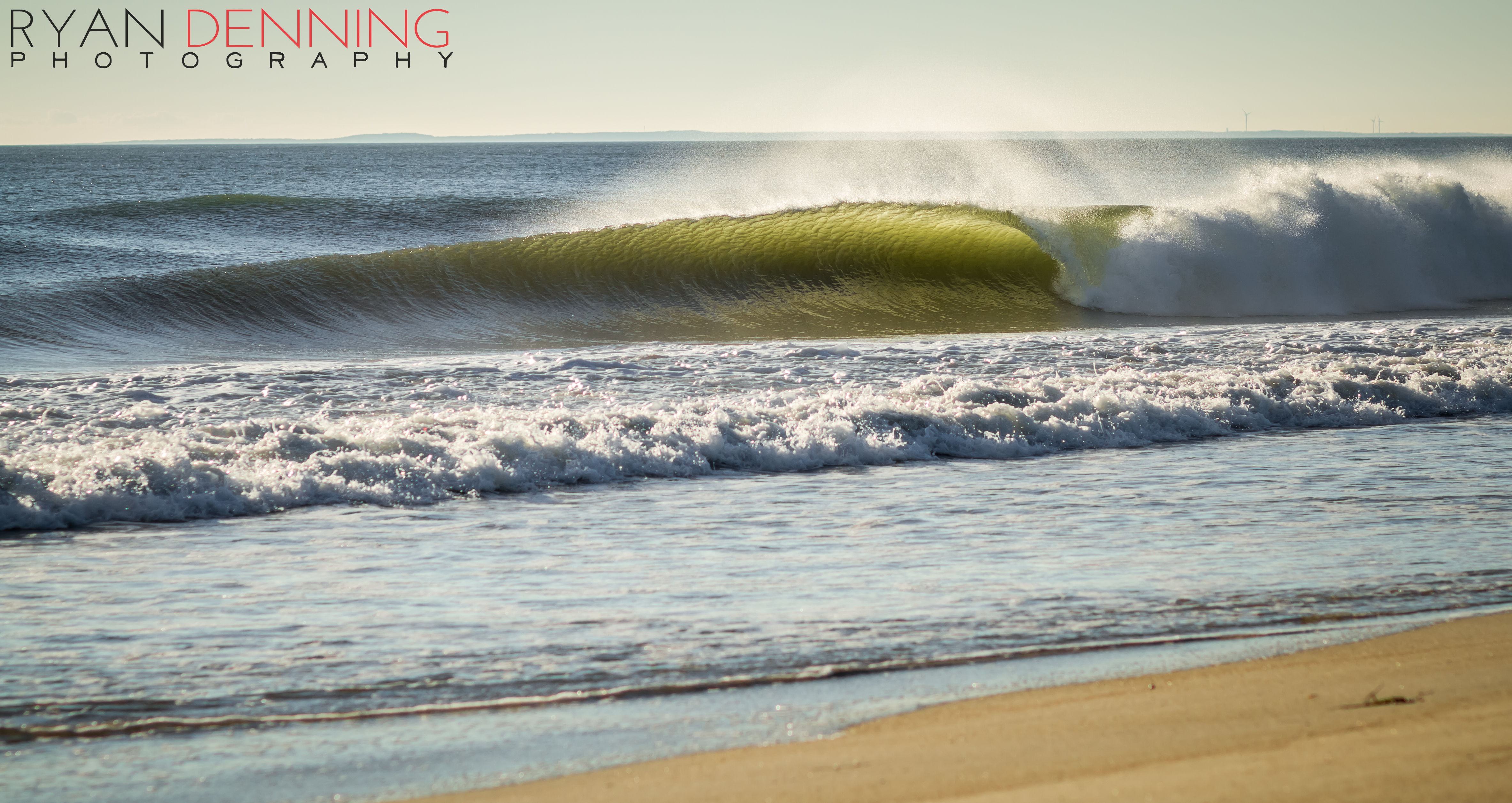
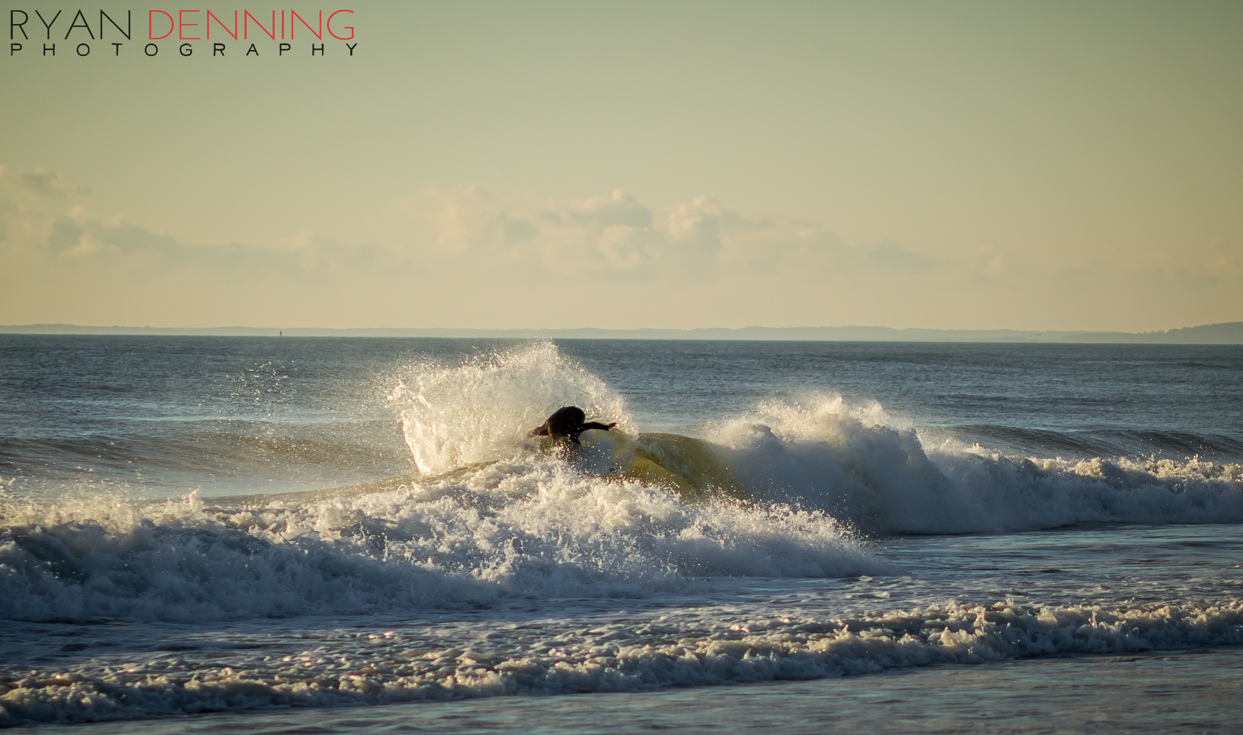
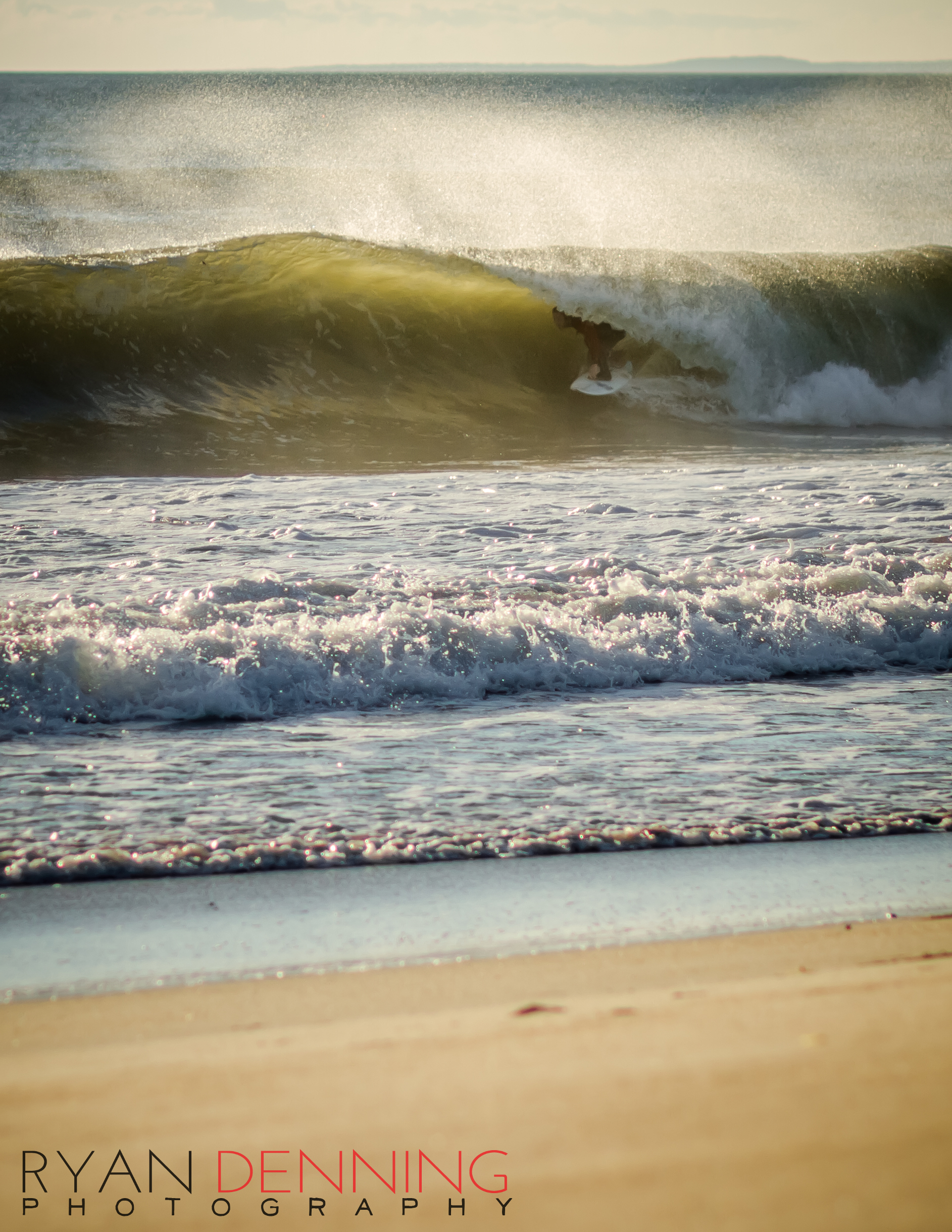
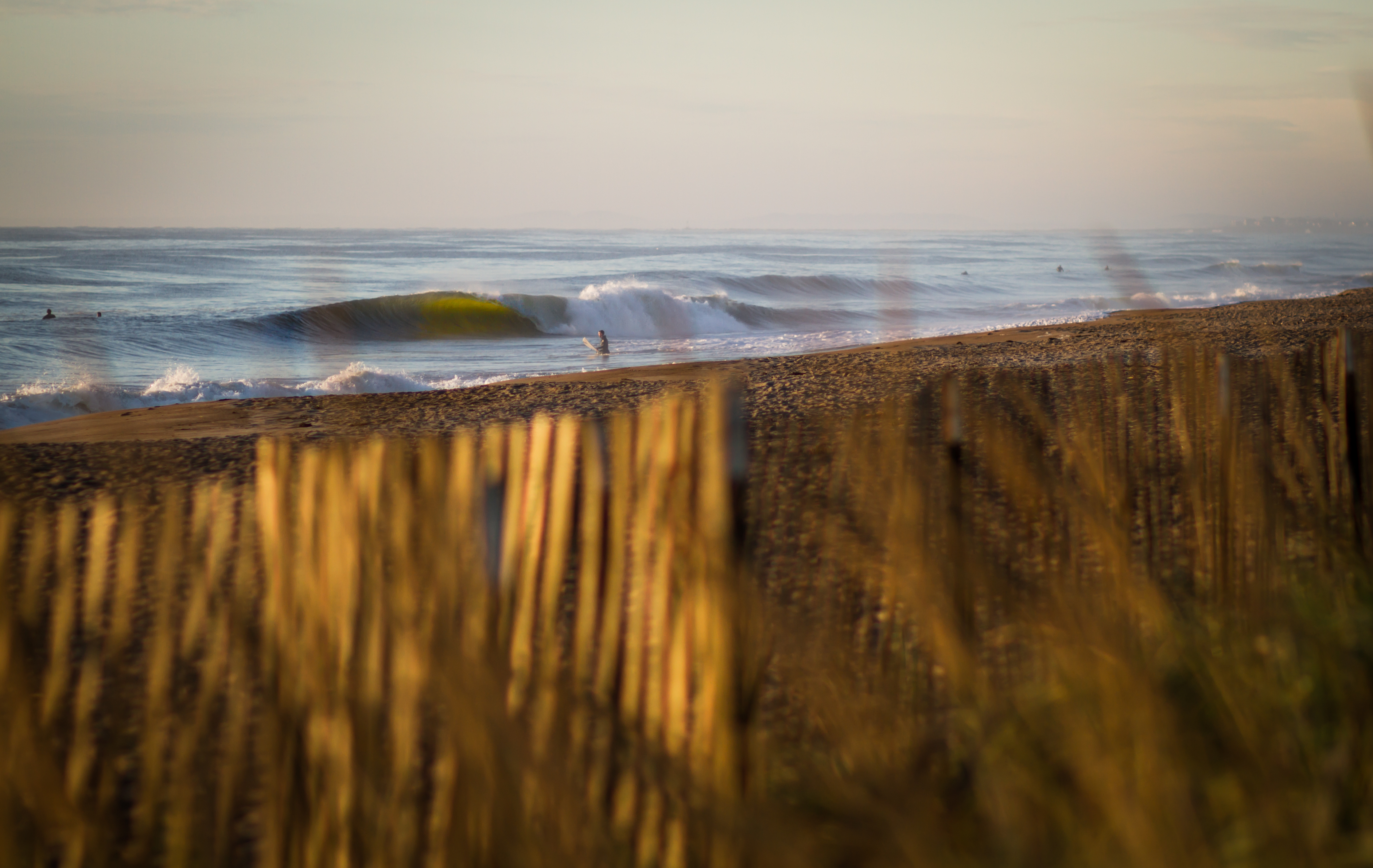
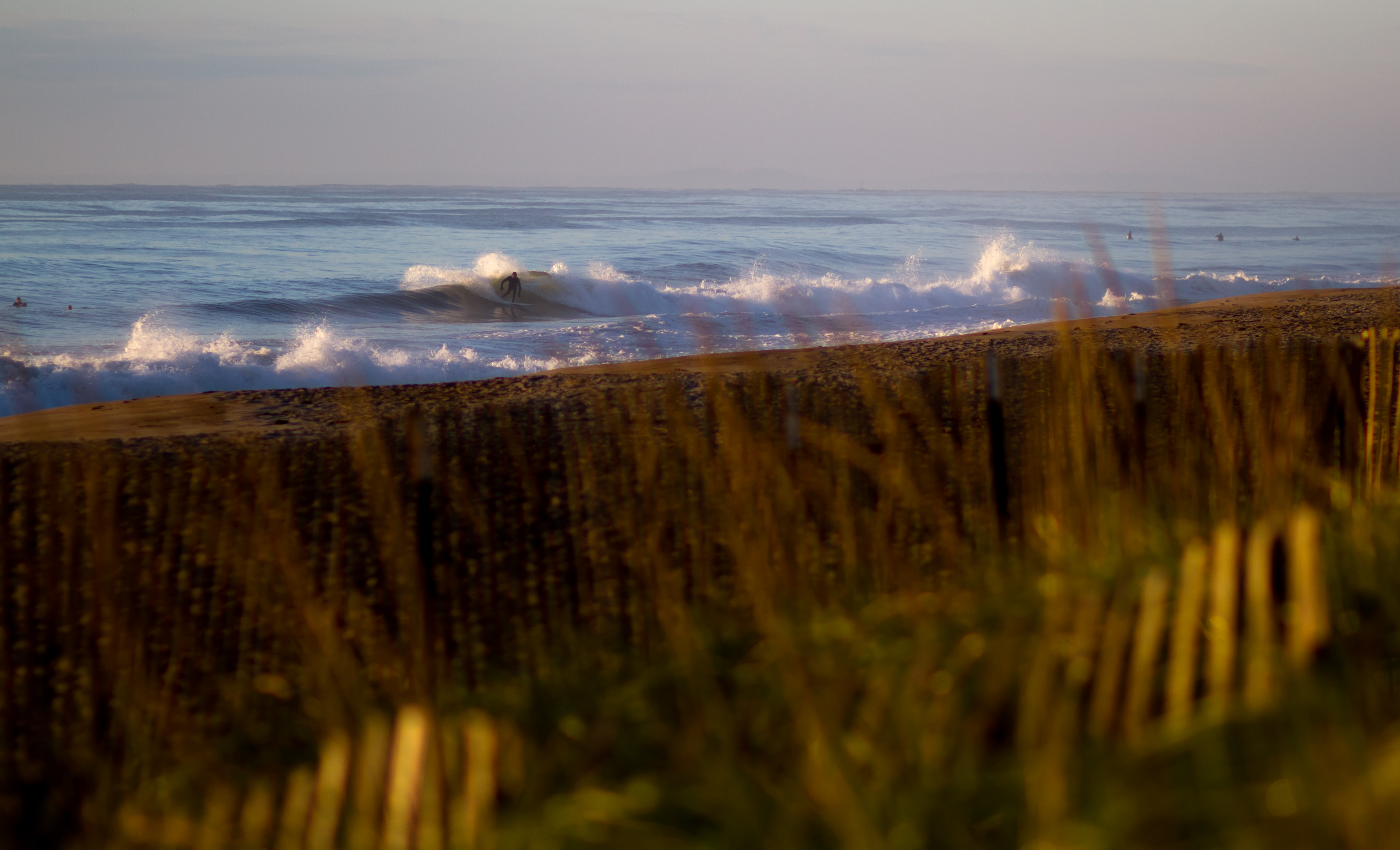
This morning was some of the finer surf I’ve seen all season. Hooked up with some boys in Maine and shot so many photos the camera over-heated. It was pumping to say the least, here is a little sample.
Igor and Julia
9-16-10 UPDATE
Igor is again intensifying, this morning the storm went through an eyewall replacement cycle, quoted from Jeff Master’s Blog on Wunderground.com “By Saturday, much of the East Coast from northern Florida to Cape Cod Massachusetts can expect waves of 3 – 4 meters (10 – 13 feet), causing dangerous rip currents and significant beach erosion.” The Hurricane Hunters have a flight into the storm scheduled for this afternoon, more accurate information to come. GET AMPED! it’s gonna be firing.
Older
Today was the second time in history that there have been two active category 4 hurricanes in the North Atlantic simultaneously, Igor and Julia. Julia is also the first ever category 4 hurricane in that part of the Atlantic. The storm is very far out, but she will be backing up Igor’s swell.
It looks as though we’ll get some serious swell energy from Igor, it’s still about 1,500 miles off the southern coast and moving quite slowly. We may even see some forerunner energy in the water by dark tomorrow night(Thursday). I have a feeling that Friday morning could be still be smaller as the swell fills in and by dark it’ll be head high. The swell will be building on Saturday and these days especially it’s pretty dangerous to be in the water, the swell is going to fill in rapidly, and each set will be bigger. Know your limits, if you’re not going to be comfortable surfing in overhead surf, don’t paddle out. Even if it’s smaller in the morning by mid-day it should be pumping and by dark will be full on 6-8ft.
 The swell is most likely going to peak on Sunday night into Monday morning and there will leftovers into the middle of the week. That could be delayed up to 24 hours depending on how slowly this storm moves up the coast. Above is a forecast track from Wunderground.com, and the other is a contrast of Southern New Hampshire and Central Maine data, Maine will be the call if the storm stays close (under ~800 miles from the coast) as it picks up that south swell much better.
Keep it locked, I’ll update tomorrow with more on swell period and Hurricane Julia.

Side note : We have some white stuff on the deck at Mount Washington! Could be some more by Saturday morning.

Igor
8-13-10 — 8:00pm UPDATE:

Well things are starting to come together. The models are showing that the storm is going to make a pass by the northeast. This should give us long period swell starting on Thursday/Friday and fading out on Wednesday. THAT’S ALMOST A WEEK OF SWELL! Excuse my excitement, I’m stoked to be surfing without the massive amount of tourists. I wanna be able to park at my favorite spot without people parked on the grass and in every illegal place possible. Igor is a Category 4 Hurricane at the moment but is quickly strengthening, another important tidbit is that it’s moving very slowly, that is why the swell is forecasted to stick around so long. We still aren’t clear on wave sizes, don’t go getting your 7″6′ pin all waxed up ’cause as of now it ain’t gonna get that big but we will see some head high+ and it will be much less crowded than the last 5 months. I will also add that we could see swell periods around 17 seconds which means you’ll have to hit up some Google Earth or find your secret spot because it’ll be closin’ the beaches out. A long point or offshore reef will be your best bet. Much more information will be available tomorrow into Wednesday. CHEERS!
8-12-10
Could be some solid swell towards the end of the week. Igor has developed into a Hurricane and will continue to head northwest up the coast. More accurate information will be available tomorrow and in coming days as the storm gets closer. Another tropical storm has developed right behind Igor, Tropical Depression Twelve should have enough room behind Igor to develop on it’s own. 
8-29-10
*Storm Chasing page updated*
I apologize in advance for the cropping issues, in an attempt to hide the locations I’ve also mangled the photos. These are shot from 3 different locations in NH/ME. Had a great session this evening with the boys up at a popular spot in Maine, beautiful sunset and glassy waist high surf.
